29.6.2015 Section 9
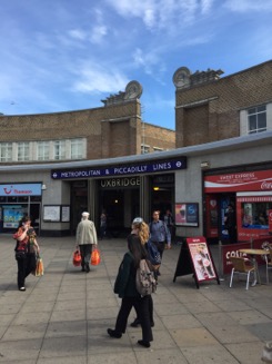
Perfect. Let’s start the 9th section of the LOOP
walk at Uxbridge tube station, right in the heart of Uxbridge.
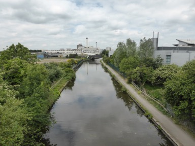
Passing the “Crown and Treaty” where way back in 1645 the commissioners of Charles I and Parliament met to try to negotiate a treaty the Grand Union Canal is reached which the path is going to follow for a few miles.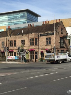
Leaving the Uxbridge Lock behind us the walk is, as mentioned, following the canal.
Green on both sides, occasionally some lovely houses.
Pure peace and tranquility.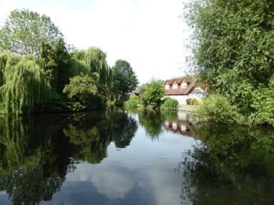
Quickly Denham Lock ( the deepest lock on the canal ) is reached quickly and now one leaves
any traffic behind and can enjoy the canal in its rural peace to the fullest.
Crossing over the the other side of the canal the Frays Valley Nature Reserve is reached.
Gravel was once quarried here and the remains can still be seen: lakes.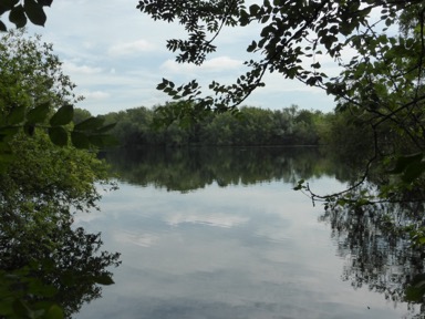
Passing a marina with rows of colorful narrow boats the path enters dense woodland where
the remains of an old barge lying high and dry on the bank can be seen.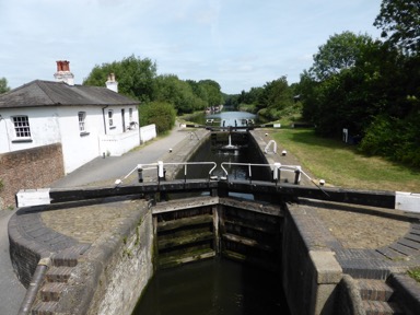
Another lock, the Wide Water one, is passed and heading on the next look follows quickly,
the Black Jack’s lock. Here on old Victorian mill stands on an island between the canal
and the river Colne.
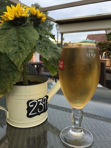
After some bends, the canal to what was once the Fisheries Inn, now named Coy Carp
and the whole spot long knows as Copper Mill. The mills have been converted in the
early 19th century from paper to making copper sheeting. The mills are now all gone
but the inn invited me to a nice lunch.
Refreshed I went on, leaving the canal and making my way uphill towards Hill End ( how appropriate )
where open spaces and rural landscape welcomes the walker before the path meanders through farmland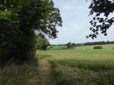
to then disappear into the Bishops Wood Country Park.
Following a winding route through the at times very thick woodland when finally arrives at the busy
A404 which needs to be crossed before disappearing again into the woods.
Before doing this one can spot one of the old London boundary markers at the roadside.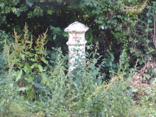
Heading one the path goes alongside the tube tracks on one side and a golf course on the other
straight to Moor Park Station the end point of todays walk.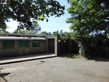
From here the Metropolitan line gets you back into London i.e. home.
Some more pictures of this section can be found here and a map with todays waypoints can be found here
This concludes the 9.section: 9 1/4 miles, 78 miles still to go.
10.6.2015 Section 8
Anyway, the main thing is that I am continuing the project to bring it to a finish.
Today started as a bright and sunny day so that the motivation was high to travel
for about 1 ½ hours by train and tube to Hatton Cross ( one stop before Heathrow airport )
to start the walk to Uxbridge. 10 ½ miles. Easy !
The first 2-3 miles have been a bit spoiled by the almost permanent rumbling of starting airplanes.
Heathrow is still close by and few industrial estates do not make it a very pleasant walk.
Along the river Crane Cranford is reached where the LOOP crosses the old border
between London and the County of MIddlesex. The latter long gone but the bridge
across the river still displaying the arms.
From now on the LOOP passes through a much more pleasant scenery: the Cranford
Country Park and the Cranford meadows. The park being the former estate of the
Earl of Berkely who bought the land in 1618 with the family departing in 1918.
Hardly anything is left of the former house. The parish church of St.Dunstan is greeting
the walker before the path goes under the M4 motorway. Passing through some dense
woodland civilisation is greeting the walker again with a very busy round-about.
A short walk and one reaches the Grand Union Canal which needs to be followed
from now on until this sections final point in Uxbridge.
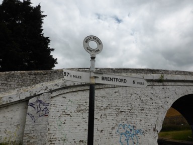
87 ½ miles to Braunston ( near Northampton ) the fingerpost shows.
Walking under lots of road bridges and even a bridge over the river Crane brings the walker to an
interesting iron milepost.
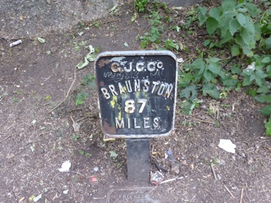
G.J.C.Co is not a company but the Grand Junction Canal. This being the original title of the
ambitious 93 mile navigation approved by Parliament in 1793. The “Union” title it took in
1929 when several canals amalgamated.Several of these signs can be found on the walk ahead.
As mentioned one needs to follow the canal for several miles. Many cyclists and walkers using the ttranquility to exercise.
At mile marker 84 the path leaves the calnal to turn into a as it turns out shortly fantastic water-world.
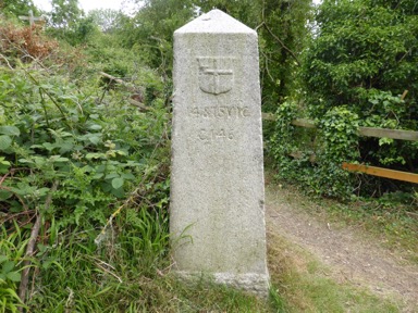
Before doing this an obscure granite obelisk is passed: a coal tax marker displaying the arms of the
City of London. One of many to be seen on the main trading approaches to London warning the
merchants that you are due to pay tax on the coal you are bringing in.
The tax was introduced in 1667 to help rebuild the city after the Great Fire.
The path leads us now into Huntsmoor Park an area with lots of streams and lakes, the biggest
one the "Little Britain" one. All once being gravel pits.
Walking through this really lovely area one reaches after some walk again industry with office
blocks in the distance: Uxbridge.
Leaving the canal one needs to pass through Uxbridge to reach the Underground station to
catch a train to bring you home.
Some more pictures of this section can be found here and for a map with the waypoints
This concludes the 8.section:10 1/2 miles, 87 1/4 m still to go.