18.9.2020 Section 2
23/09/20 13:07
Thanks to Covid-19 there aren't any excuses to postpone to walk another section of the CRW.
Especially as this time I have also some fellow walkers who joined me: my long friends
Gitte & Günther.
O.K. then, great weather, sunny with very pleasing temperatures so the three of us headed via
public transport ( wearing of course a mask ! ) to Falconwood Station where section 2 of the CRW starts.
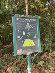
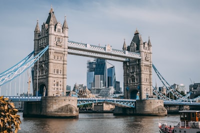
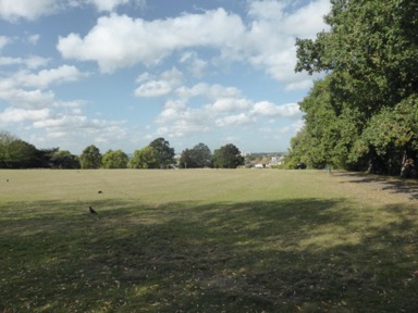
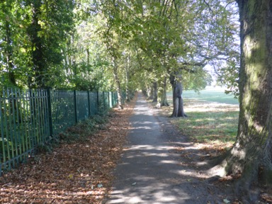
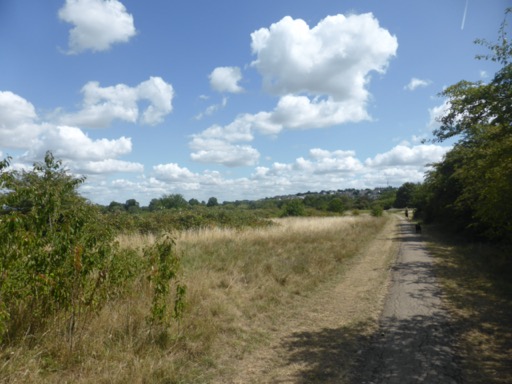
Walking through the dense Oxleas Wood forest we reached Eltham Park South with its great views of the London skyline
.
Walking along quit Eltham street we reached the area of Eltham Palace. Alongside the path one of the very few "attractions" of this section of the walk: the remnants of the Eltham Palace water supply system
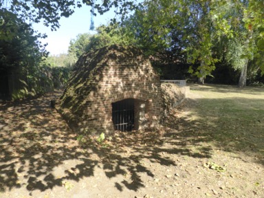 dating back to around 1509 and
obviously not working anymore.
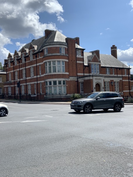
Walking along North Park Road we reached the grounds of Eltham Palace, the old palace of the crown
with its Great Hall dating back to 1476 ( you may recall that I am volunteering here ). Before you
ask: no we didn't visit the grounds and the house.
We just peaked across the old Moat Bridge ( dating back to 1370 ) to get a glimpse of the "annex" the old hall, the Art Deco home of the Courtaulds who lived here from 1933- 1944.
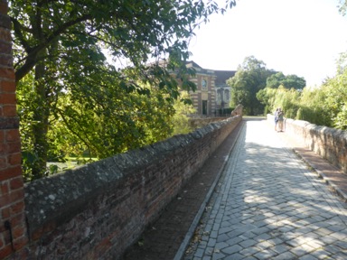
Walking like kings on the old " King Johns Walk" we reached the
backside of the house with again great views of London:
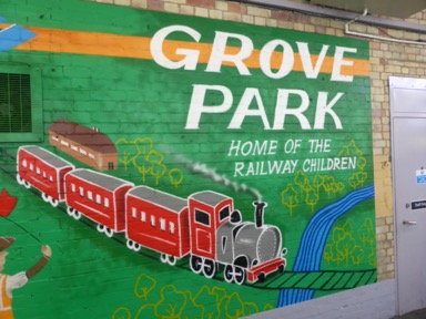
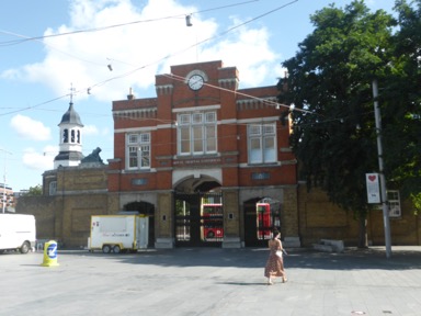
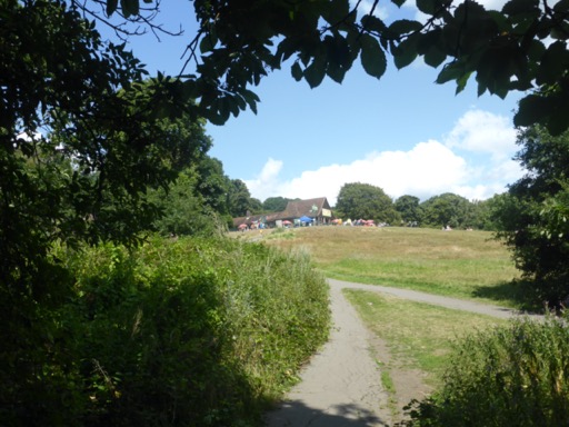
From here it was a relatively short walk to "Grove Park Station" where section 2 finished.
This concludes the 2.section: 3.5 miles, 68.30 miles still to go.
Some more pictures of this section can be found here and a map with todays waypoints can be found here
Especially as this time I have also some fellow walkers who joined me: my long friends
Gitte & Günther.
O.K. then, great weather, sunny with very pleasing temperatures so the three of us headed via
public transport ( wearing of course a mask ! ) to Falconwood Station where section 2 of the CRW starts.
Walking through the dense Oxleas Wood forest we reached Eltham Park South with its great views of the London skyline
.
Walking along quit Eltham street we reached the area of Eltham Palace. Alongside the path one of the very few "attractions" of this section of the walk: the remnants of the Eltham Palace water supply system
dating back to around 1509 and obviously not working anymore.
Walking along North Park Road we reached the grounds of Eltham Palace, the old palace of the crown
with its Great Hall dating back to 1476 ( you may recall that I am volunteering here ). Before you
ask: no we didn't visit the grounds and the house.
We just peaked across the old Moat Bridge ( dating back to 1370 ) to get a glimpse of the "annex" the old hall, the Art Deco home of the Courtaulds who lived here from 1933- 1944.
Walking like kings on the old " King Johns Walk" we reached the
backside of the house with again great views of London:
From here it was a relatively short walk to "Grove Park Station" where section 2 finished.
This concludes the 2.section: 3.5 miles, 68.30 miles still to go.
Some more pictures of this section can be found here and a map with todays waypoints can be found here
2.8.2020 Section 1
02/08/20 17:52
Having just finished the London Loop Walk I didn't want to let a lot of time pass to start with
the next walk in and around London, the Capital Ring Walk. This 78 miles long footpath is
seeking out a hidden corridor of green space around inner London.
With not a lot of interesting things today anymore ( thank you Corona ) I decided to give it a start
on this very day. Weather great, not to hot but still sunny. With other words: perfect.
With the first section starting only a short bus ride away from home in Woolwich I was on my way already
walking from home to my local bus stop boarding the 51 bus to get me to Woolwich where I started the walk
( o.k. its not the "official" starting point ) at the gate-house to the former Royal Arsenal
 which was at this place from 1545. This place is famous for
its football club. In 1886 the workers formed the club first known as Dial Square Club, then Royal Arsenal, then Woolwich
Arsenal and finally plain Arsenal ( or simply the "Gunners", guess why ! ).
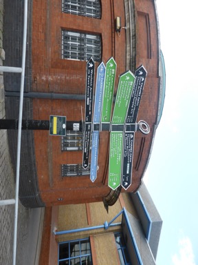
Just a short walk away, at the entry / exit of the Woolwich foot-tunnel the Capital Ring Walk starts
 just a few steps away from the Woolwich ferry
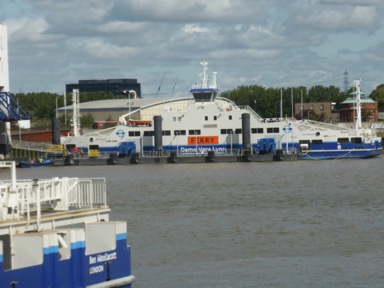 which didn't run today ( maintenance work ! ). Alongside the river the path goes always a gentle breeze cooling the walker nicely.
Interesting stairs across the Thames flood defences ( the Thames Barrier is a short walk upstream ! ) and old dry docks ( now filled up with water for fishing
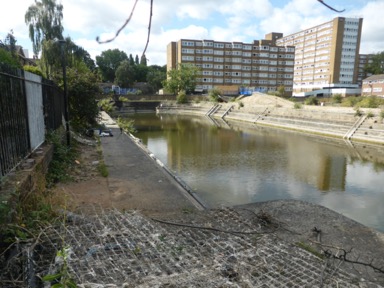 make the walk interesting as well and ar a sign of the former maritime heritage of this place.
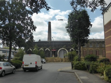
Leaving the river path after looking upstream to see the Thames River Barrier ( completed in 1984 after the original idea came up after the disastrous 1953 flood when over 300 people drowned and caused immense damage ) one crosses the Henry's Wharf
Estate which occupies the former site of the Naval Dockyards Steam Factory. One a lonely brock building with a tall chimney has survived
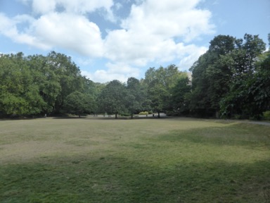
The next few hundred yards are rather dull as they path is alongside a rather busy road before crossing the same and to emerge into Maryon Park. Maryon Par=k and the following Maryon Wilson Park are named after a family which owned here sandpits, the source of sand used as floor coverings before carpets became widely available. The pits have been donated by the family to the London County Council in 1891 and are now two lovely widely used parks.
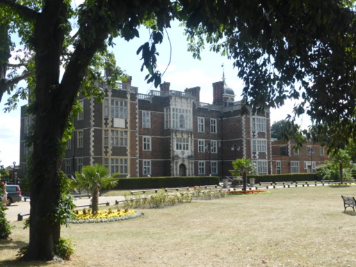
 widely used parks. The path meanders through both parks passing a children's zoo followed by several stairs where at the end one has to leave the Maryon Wilson park. Having crossed a road the walk continues into Charlton Park which houses Charlton House, one of the finest Jacobean buildings in London, completed in 1612. It was build for Sir Adam Newton, the tutor to Prince henry, son of King James I.
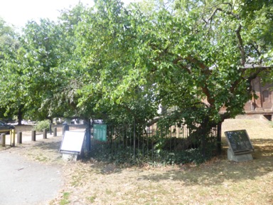
 Next to the house an over 400 year old mulberry tree can be seen
 The walk goes through the whole estate and after a short walk through a residential area goes into Hornfair Park with its BMX track. Heading on the path briefly "touches" the grounds of the former military hospital now NHS Queen Elizabeth to disappear into Woolwich common.
 YES this is London. At far end of the common are the Royal Artillery Barracks where during the 2012 Olympics and Paralympics the temporary stadium for the shooting was based.
Shooters Hill rising at the horizon. The Shooters Hill crossing with its former Police Station is quickly reached
 Having crossed the busy Shooters Hill Road
the foot-path leads the walker across Eltham Common. This road was once a roman road from Dover to London. Shooters Hill itself is with its 432 feet ( 130 meters ) one of the highest points in London.
The path is slowly climbing through the thick Castle Wood forest to reach at the top the highest point of the whole Capital Rind Walk: 419 feet ( 128 meters ) and , more importantly Severndroog Castle. It's strange name acmes from a fortress in India which was captured by Commodore Sir William James who during the 18th century owned this land. His wife build the tower of his death in 1784 as a memorial. From its top one has ( if open !, was closed today because of Corona ) a fantastic view of London.
The path dives now into Oxleas Wood, one of the oldest still existing forests in London, passing a few places where remains of former manor houses ( Castelewood House and Jackwood House ) can still be seen.
After a short climb to the top which is crowned with a hut. All very much resembles an alpine landscape.
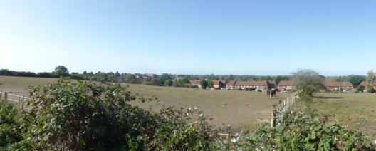
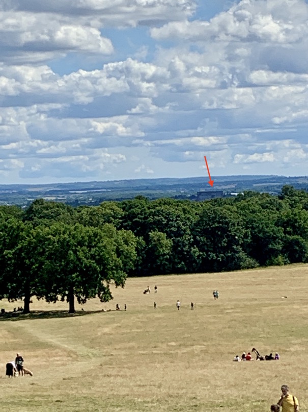
Fantastics views from up here and if you know what you are looking for one can spot the big brown office building right next to Sidcup Station
From the top the foot-path meanders slowly downhill to reach the end of Oxleas Wood which is also the end of the first section of the walk
 a short walk get one to Falconwood Station.
This concludes the 1.section: 6.2 miles, 71.8 miles still to go.
Some more pictures of this section can be found here and a map with todays waypoints can be found here
the next walk in and around London, the Capital Ring Walk. This 78 miles long footpath is
seeking out a hidden corridor of green space around inner London.
With not a lot of interesting things today anymore ( thank you Corona ) I decided to give it a start
on this very day. Weather great, not to hot but still sunny. With other words: perfect.
With the first section starting only a short bus ride away from home in Woolwich I was on my way already
walking from home to my local bus stop boarding the 51 bus to get me to Woolwich where I started the walk
( o.k. its not the "official" starting point ) at the gate-house to the former Royal Arsenal
which was at this place from 1545. This place is famous forits football club. In 1886 the workers formed the club first known as Dial Square Club, then Royal Arsenal, then Woolwich
Arsenal and finally plain Arsenal ( or simply the "Gunners", guess why ! ).
Just a short walk away, at the entry / exit of the Woolwich foot-tunnel the Capital Ring Walk starts
just a few steps away from the Woolwich ferry which didn't run today ( maintenance work ! ). Alongside the river the path goes always a gentle breeze cooling the walker nicely.Interesting stairs across the Thames flood defences ( the Thames Barrier is a short walk upstream ! ) and old dry docks ( now filled up with water for fishing
make the walk interesting as well and ar a sign of the former maritime heritage of this place.Leaving the river path after looking upstream to see the Thames River Barrier ( completed in 1984 after the original idea came up after the disastrous 1953 flood when over 300 people drowned and caused immense damage ) one crosses the Henry's Wharf
Estate which occupies the former site of the Naval Dockyards Steam Factory. One a lonely brock building with a tall chimney has survived
The next few hundred yards are rather dull as they path is alongside a rather busy road before crossing the same and to emerge into Maryon Park. Maryon Par=k and the following Maryon Wilson Park are named after a family which owned here sandpits, the source of sand used as floor coverings before carpets became widely available. The pits have been donated by the family to the London County Council in 1891 and are now two lovely widely used parks.
widely used parks. The path meanders through both parks passing a children's zoo followed by several stairs where at the end one has to leave the Maryon Wilson park. Having crossed a road the walk continues into Charlton Park which houses Charlton House, one of the finest Jacobean buildings in London, completed in 1612. It was build for Sir Adam Newton, the tutor to Prince henry, son of King James I. Next to the house an over 400 year old mulberry tree can be seen The walk goes through the whole estate and after a short walk through a residential area goes into Hornfair Park with its BMX track. Heading on the path briefly "touches" the grounds of the former military hospital now NHS Queen Elizabeth to disappear into Woolwich common. YES this is London. At far end of the common are the Royal Artillery Barracks where during the 2012 Olympics and Paralympics the temporary stadium for the shooting was based.Shooters Hill rising at the horizon. The Shooters Hill crossing with its former Police Station is quickly reached
Having crossed the busy Shooters Hill Roadthe foot-path leads the walker across Eltham Common. This road was once a roman road from Dover to London. Shooters Hill itself is with its 432 feet ( 130 meters ) one of the highest points in London.
The path is slowly climbing through the thick Castle Wood forest to reach at the top the highest point of the whole Capital Rind Walk: 419 feet ( 128 meters ) and , more importantly Severndroog Castle. It's strange name acmes from a fortress in India which was captured by Commodore Sir William James who during the 18th century owned this land. His wife build the tower of his death in 1784 as a memorial. From its top one has ( if open !, was closed today because of Corona ) a fantastic view of London.
The path dives now into Oxleas Wood, one of the oldest still existing forests in London, passing a few places where remains of former manor houses ( Castelewood House and Jackwood House ) can still be seen.
After a short climb to the top which is crowned with a hut. All very much resembles an alpine landscape.
Fantastics views from up here and if you know what you are looking for one can spot the big brown office building right next to Sidcup Station
From the top the foot-path meanders slowly downhill to reach the end of Oxleas Wood which is also the end of the first section of the walk
a short walk get one to Falconwood Station.This concludes the 1.section: 6.2 miles, 71.8 miles still to go.
Some more pictures of this section can be found here and a map with todays waypoints can be found here
Planning has started
25/07/20 11:32
The map of the walk I bought and now it's only a matter of starting.
Watch this space !
Watch this space !